POTENTIAL FREEZE late this weekend.
In collaboration with AWIS Weather ServiceWelcome back to the most challenging time of the year!
The warm weather this week - together with plenty to accumulated chilling hours over the past month - most likely has pushed buds on your vines quite a bit.
If that is the case, the predicted freeze event this weekend/early next week might cause some bud damage. We are expecting winds, rain and cold air moving in from up North into mid Atlantic and the Southeastern shore.
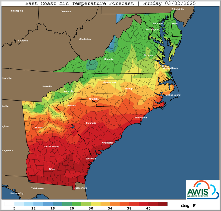
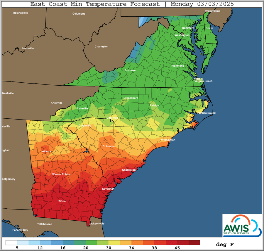
We are expecting at the moment minimum temperatures in the low 20s for Monday (3/3/2025) morning in most of North Carolina.
These are conditions that might damage grapevine bud tissue, depending on where your current status of vine physiology. With some variance due to wind speed, cloud cover, and the relative dryness of the air, the temperatures (degrees F) that will damage grape buds are:
- dormant bud <20˚F;
- dormant swollen = 26˚F;
- burst bud = 28˚F;
- one leaf unfolded = 28-29˚F;
- two leaves unfolded = 29-32˚F.
Some of you might already see swollen buds... Check especially Merlot, Chardonnay, Malbec and other early candidates.
If you are in this situation, and you haven't pruned yet, or you are on a double pruning system, best would be to wait with pruning until the freeze is over. The predicted weather pattern will probably not allow for much overhead sprinklers (depending on the local wind activity), and wind machines will most likely not work. This is a freeze, not a frost!
Either way, stay alert and we will keep you updated as this event will come closer over the weekend.General Weather Discussion
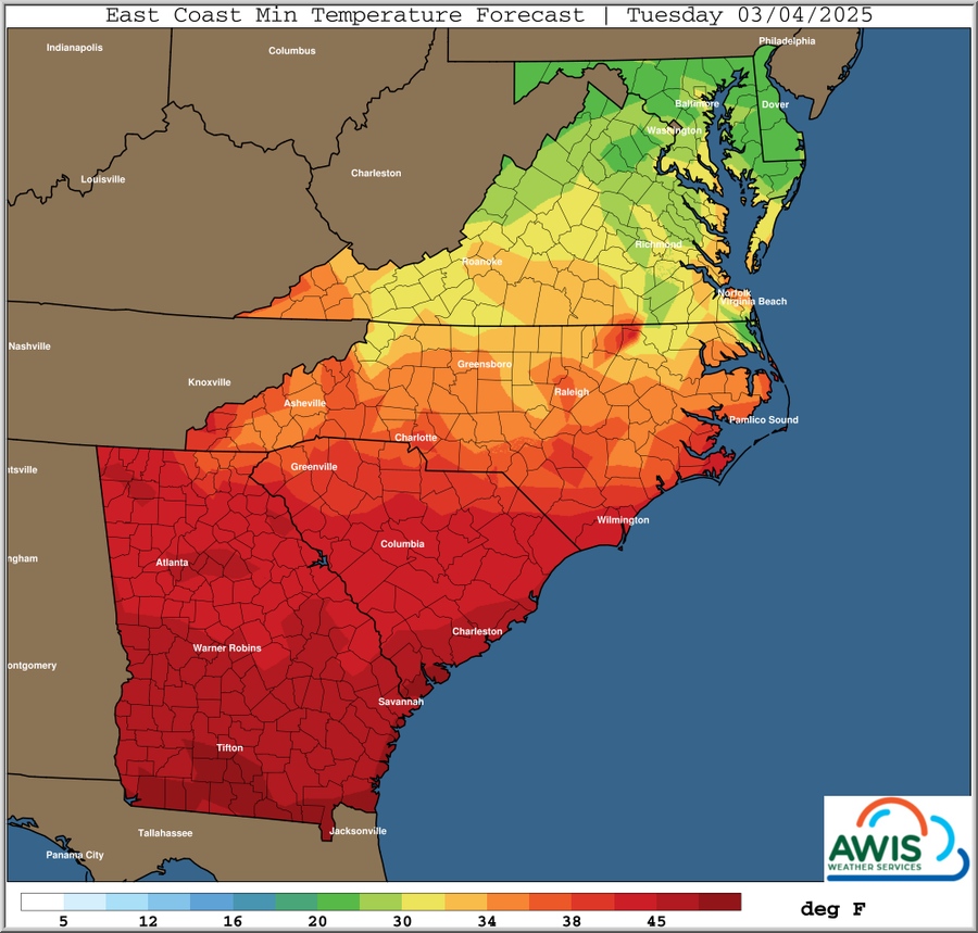
*** Quick Update For Colder Air Late This Weekend *** Hard Freeze Potential, Mainly Monday Morning *** Warmer Middle Half Next Week *** Increased Rain Threat Middle-End Next Week *** Potentially Colder Again Late Next Week, Next Weekend As is typical this time of year, minor changes in the upper air pattern can yield enough changes in local temperatures to be aware of.Such is the case as a clipper-like system will move through the Great Lakes and into the Northeast Friday and Saturday with another quick shot of polar/arctic air behind it. This will allow another surge of cold air from Canada to dig Southeast, with another hard freeze potential by early next week, with minimums 20-25 ranges.
After that a warmup and increasing shower chances later next week, followed by another cool down behind that towards the following weekend. Given the dynamic weather pattern ahead, please stay alert to daily updates for potential changes that may impact critical management decisions.