AWIS Weather Advisory: Frost Threat late weekend, early next week.
In collaboration with AWIS Weather ServicesDear all,
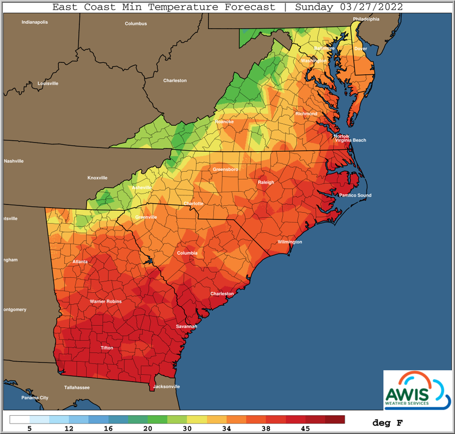
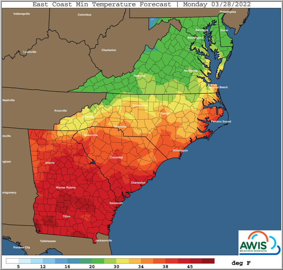
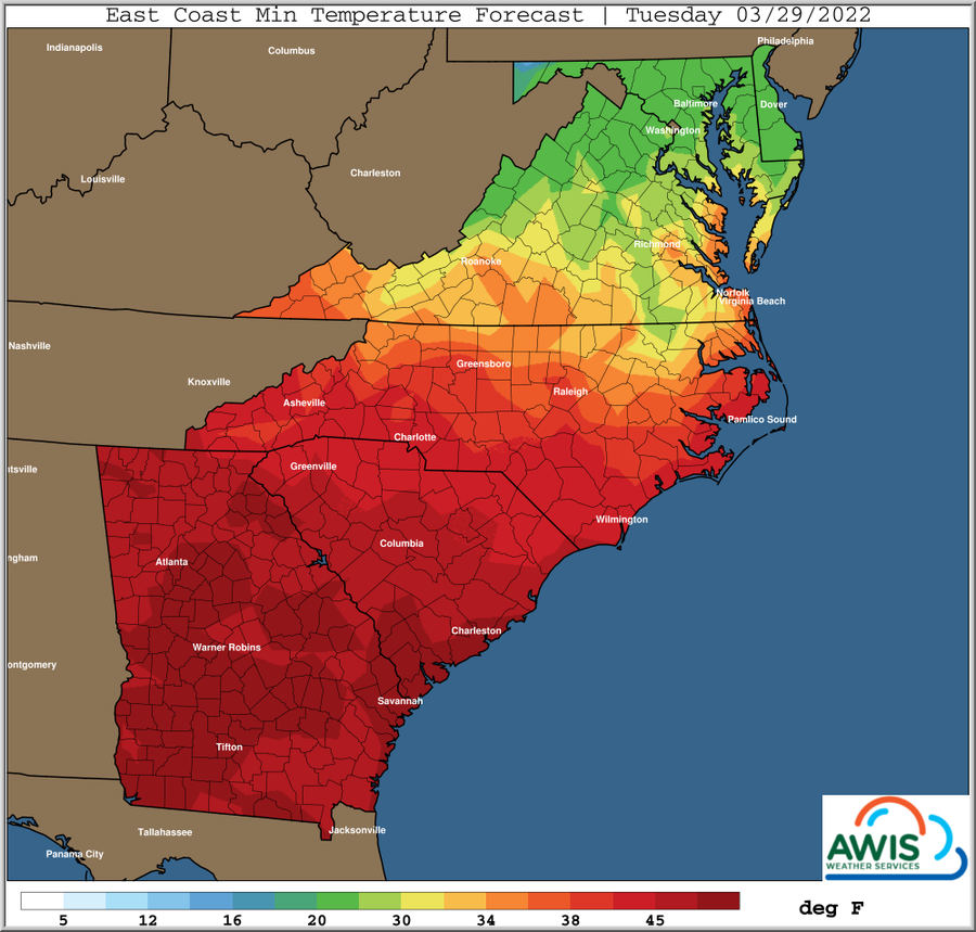
Frost is very likely in the central and western parts of North Carolina and most of Virginia, coming Sun to Tue, with a high likelihood on Monday Morning (see Fig 1). In some areas, early bud breaking cultivar are in bud swell already. While this is very early in the season, the upcoming frost will be a threat on some cultivars, especially for Chardonnay in the Yadkin Valley!
Wind machines most likely will not work, since larger airmasses are causing the predicted cold temperatures. We recommend to use overhead sprinkler systems (if you have them) to save some of your primary bud. Please see this publication for more details on cold management in grapes.
Since every cold protection method inherits some risk, we recommend to only think of cold protection if you are more than 10% into bud swell!
If you have implemented delayed winter spur pruning on your early cultivars, do not implement the final prune until after the frost event. Delayed winter spur pruning is the best tool to delay bud break, and often useful to avoid early spring frost damages.General Discussion
*** Low Rain Chances Through Weekend, Some winds *** Freeze and/or Frost Risks Some Areas Sun-Tue Mornings *** Freeze/Frost Threat Greatest Monday Morning, Carolinas' Northward *** Perhaps Frost Threat Tuesday Morning Northern/Eastern Areas *** Warmer Middle / End Of Next Week *** Next Rain Chances Not Until Late Next WeekA couple weaker disturbances will move SE through
the main upper trough, but will not produce much if any rainfall
Friday into the weekend, just mostly periods of clouds and
variable winds, along with cooler temperatures.
The last weak disturbance will push SE through the Mid-Atlantic
and SE states on Saturday, with the coldest air behind this
for late this weekend into early next week.
Growers need to be ready for a potential freeze as early
as Sunday morning some areas. This affects mainly parts of Western NC, VA and North.Most likely a potential freeze and/or frost will be
next Monday morning.