Heavy Rains In the Coming Days
*** Tropical Rains An Increasing Threat Southern Appalachians
*** Heavy Rain Threat Could Extend in Central Appalachians
*** Highest Rain Threat Next Monday - WednesdayGeneral Discussion
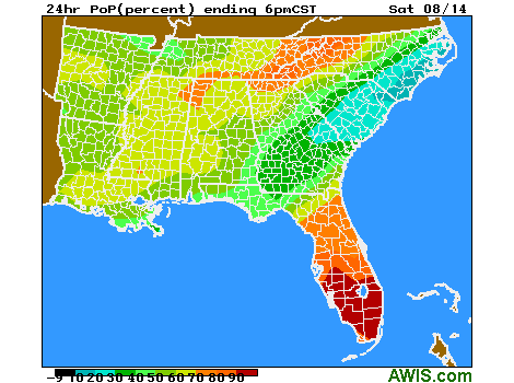
Areas of the Central and Southern Appalachians have received 1-3 inches of rain this week from daily scattered showers and storms. Additional scattered showers and storms the next couple days will add to these totals, with daily local totals of an inch or more possible. However, the main threat ahead will be rains pushing Northward from Tropical system Fred.
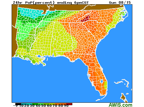
Fred is expected to begin a turn to the Northwest over the weekend, moving close to the South and SW Florida Peninsula and then out into the Eastern Gulf of Mexico. It will then head towards the Northeast Gulf Coast, likely making landfall around Apalachicola, FL early next Monday morning. A continued Northward push through Eastern Alabama or Western Georgia is expected early next week. As Fred pushes Northward, tropical moisture will as well. This moisture will be given an added boost to generate rain as it rises over the Eastern rim of the Southern Appalachians foothills and mountains.
Rain totals Monday through Wednesday could total 3-6 inches and locally more. Best chances for heaviest rains extend from West and SW Virginia through Western NC, NW SC and North Georgia, particularly the East and South slope facing areas of the Appalachians.
As we get closer to the end of next week, rainfall should become more scattered again, along with rising temperatures and a little higher di-urnal temperature ranges, but still humid.
We recommend to control especially downy mildew and bunch rots before the rain. Please follow the recommendations of the Southern Regional Small Fruits Consortium.